30-Day Muztagh Ata Trek from Islamabad with Karakul Lake and Hunza
About This Tour
Join an expedition to Muztagh Ata (7,546 m), the "Ice Mountain's Father," in China's Xinjiang province. This 30-day journey travels overland from Islamabad thro...
Duration: 30 Days · Tour type: Private · Activity level: Challenging · Accommodation: Included · Standard · Transport: Included · Wheelchair access: No · Cities: Islamabad, Gilgit, Hunza, Karakul Lake, Naran, Besham · Languages: English
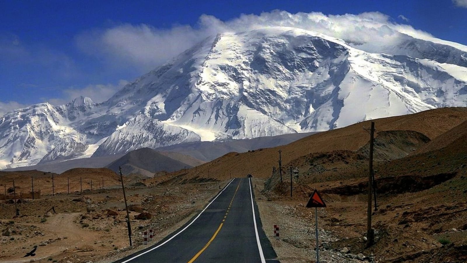
Know before you go: Muztagh Ata lies on the broad plains of western China. In appearance, it is a broad and lofty peak with gently angled flanks. The climbing route is moderately straightforward, with only a couple of steeper sections. The whole climb can be skied down and is not particularly difficult.; Approach the mountain through Pakistan by road to Gilgit and then over Khunjerab Pass (the border between Pakistan and China) to Karakul Lake. The last leg involves a camel trek to base camp at around 4,200 m.; We will visit varied and interesting places and have established an excellent liaison with the locals, helping to secure good-quality accommodation, transport, and food.; Visit Kashgar in western China, a major settlement during the Silk Road days.; It is a 30-day trip from Islamabad to Islamabad.
About Karakul Lake

Karakul Lake
Explore the list of top ranked local tour guides in Karakul Lake. Get tour activities offered by tour companies and independent travel guides in Karakul Lake.
What's Included
- Liaison with the Gilgit-Baltistan tourism department for the climbing permit process
- Processing of import or export permits from the Ministry of Tourism
- Clearance of cargo before the arrival of the team and its storage
- Assistance upon arrival and departure
- Briefing or debriefing at the Tourism Department
- Hotel accommodation in Rawalpindi or Islamabad, Hunza, Chilas, and Skardu
- All meals during the trek and at base camp, as per the itinerary
- Porterage of 75 kg per person of expedition equipment and high-altitude food, etc. to base camp, and 50 kg per person on return from base camp
- Road transfers between the airport and hotel, and within the city, as per the itinerary
- Local Pakistani tour guide
- Sleeping tents, mattresses, mess, kitchen and toilet tent, with tables, field stools, and camping ground fees
- Kitchen equipment, crockery, cutlery, fuel, and related community gear
- Wages and basic kit of the English-speaking guide, Sardar, cook, and assistant
- Insurance of our field staff and low-altitude porters, except helicopter rescue
- Porterage at airports and hotels, toll taxes, and parking fees
- Mail handling and forwarding to base camp or overseas, except postage charges
- The hiring of HAPs and any other crew as required (wages and kit to be arranged by the team)
- Pollution and environmental fees, or any other fee required to be paid to the Government of Pakistan
- One bottle of mineral water per person per day in cities
Not Included
- Climbing permit fee
- Liaison Officer kit and equipment, allowances, travel, hotels, meals, insurance, and personal expenses of any kind
- International and domestic airfare, airport tax, and excess baggage charges
- Surface transfers in case of flight cancellations to the kick-off point
- High-altitude porters or any crew above base camp
- Tents, sleeping bags, personal and climbing equipment of any kind beyond base camp, including high-altitude food and oxygen
- Medications, ground evacuations, and helicopter rescue charges of any kind
- Room service, laundry, beverages, phone or communication bills, and items of a personal nature
- Insurance liability of member(s) and others under force majeure conditions
- Clearing agent charges
- Any other service not mentioned in this condition sheet
- Domestic or international airfare and airport taxes
- Any expense due to force majeure, flight cancellation, landslides, natural calamities, acts of God, or other circumstances beyond our staff's and suppliers' control
- Any expense of a personal nature and additional cold drinks
Itinerary
-
1Day 01
Arrival in Islamabad
Arrive at Islamabad International Airport, meet your tour guide, and transfer to the hotel. Arrive at Islamabad International Airport, meet your tour guide, and transfer to the hotel. Reach the hotel for dinner and an overnight stay. Reach the hotel for dinner and an overnight stay.
-
2Day 02
Drive from Islamabad to Bisham
Take a 7-hour drive along the Karakoram Highway to reach Bisham. Take a 7-hour drive along the Karakoram Highway to reach Bisham. Arrive at the hotel in Bisham for dinner and an overnight stay. Arrive at the hotel in Bisham for dinner and an overnight stay.
-
3Day 03
Drive from Bisham to Gilgit
Take a 9-hour drive to Gilgit. Take a 9-hour drive to Gilgit. Arrive at a hotel in Gilgit for dinner and an overnight stay. Arrive at a hotel in Gilgit for dinner and an overnight stay.
-
4Day 04
Gilgit to Hunza and Sust via Attabad Lake
Drive to Hunza from Attabad Lake and then continue to Sust. Drive to Hunza from Attabad Lake and then continue to Sust. Arrive at a hotel in Sust for dinner and an overnight stay. Arrive at a hotel in Sust for dinner and an overnight stay.
-
5Day 05
Cross into China and reach Tashkurgan
Cross the Chinese border to reach Tashkurgan. Cross the Chinese border to reach Tashkurgan. Arrive in Tashkurgan for dinner and an overnight stay. Arrive in Tashkurgan for dinner and an overnight stay.
-
6Day 06
Scenic drive to Karakul Lake
Drive to Karakul Lake through breathtaking scenery of high mountain pastures and snow-capped peaks. Drive to Karakul Lake through breathtaking scenery of high mountain pastures and snow-capped peaks. Overnight stay in Karakul.
-
7Day 07
Trek from Subash Village to Base Camp
Take a short drive to Subash Village and begin walking to base camp, with camels carrying the team's equipment. Take a short drive to Subash Village and begin walking to base camp, with camels carrying the team's equipment. Trek over a level plain and then climb steadily through barren hills to reach base camp in about 4 hours. Trek over a level plain and then climb steadily through barren hills to reach base camp in about 4 hours. Arrive at base camp for dinner and an overnight stay. Arrive at base camp for dinner and an overnight stay.
-
8Day 08
Acclimatization and preparation at Base Camp
Base camp is at an altitude of approximately 4,350 m (14,500 ft), so time is needed to adapt to the altitude. The grassy site is tucked between a moraine and the foot of the steeper slopes of the mountain - a great place to relax now and recover later. Base camp is at an altitude of approximately 4,350 m (14,500 ft), so time is needed to adapt to the altitude. The grassy site is tucked between a moraine and the foot of the steeper slopes of the mountain - a great place to relax now and recover later. Enjoy some fresh food and prepare for the next day's trek. Enjoy some fresh food and prepare for the next day's trek. Overnight stay at base camp.
-
9Day 09
Begin the ascent of Muztagh Ata
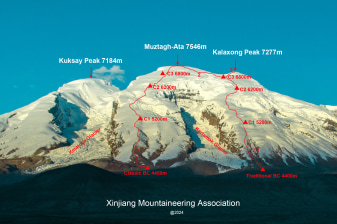
Climb Muztagh Ata.We use three camps above base camp.The first camp is likely to be close to the snow line. In this case, we will use pack animals to transport all expedition supplies to Camp 1.Above this point, all team members will need to participate in load-carrying between camps. In addition to putting the necessary supplies in place, this also provides essential acclimatization and fitness for the summit attempt.Camp 1 is at about 5,350 m, reached by a steep, stony ascent from base camp, and sits right on the edge of the glaciers that blanket the upper 2,000 m of the mountain.From Camp 1, the route is a steady ascent up a snowy and sometimes icy slope through an area of crevasses and a small "valley" in the glacier. This is the steepest part of the whole route.Above the "valley," a long and unrelenting ascent leads up to Camp 2, a small shelf in the glacier at about 6,100 m. There will probably be 2 or 3 ascents to Camp 2, carrying loads for this camp and the one above. This is great for acclimatization and for skiers, as there is an 800 m run back to Camp 1 with an empty sack.It is possible to fix a camp virtually anywhere on the upper part of the mountain. The leaders will choose where to site camps, taking into account prevailing conditions and the activities of other parties on the mountain. In recent years, the next camp has been placed at 6,450 m. Alternatively, teams may use Camp 3 at 6,800 m. Issues such as acclimatization, load-carrying, snow conditions, sleeping comfort, and average group speed will be considered when deciding what approach to use.The route to the summit is straightforward from 6,800 m to 7,400 m. A long gradual slope slowly eases, becoming gentler and gentler. Finally, with the ground appearing almost level, the small rise to the summit rock appears. Climb Muztagh Ata. We use three camps above base camp. We use three camps above base camp. The first camp is likely to be close to the snow line. In this case, we will use pack animals to transport all expedition supplies to Camp 1. The first camp is likely to be close to the snow line. In this case, we will use pack animals to transport all expedition supplies to Camp 1. Above this point, all team members will need to participate in load-carrying between camps. In addition to putting the necessary supplies in place, this also provides essential acclimatization and fitness for the summit attempt. Above this point, all team members will need to participate in load-carrying between camps. In addition to putting the necessary supplies in place, this also provides essential acclimatization and fitness for the summit attempt. Camp 1 is at about 5,350 m, reached by a steep, stony ascent from base camp, and sits right on the edge of the glaciers that blanket the upper 2,000 m of the mountain. Camp 1 is at about 5,350 m, reached by a steep, stony ascent from base camp, and sits right on the edge of the glaciers that blanket the upper 2,000 m of the mountain. From Camp 1, the route is a steady ascent up a snowy and sometimes icy slope through an area of crevasses and a small "valley" in the glacier. This is the steepest part of the whole route. From Camp 1, the route is a steady ascent up a snowy and sometimes icy slope through an area of crevasses and a small "valley" in the glacier. This is the steepest part of the whole route. Above the "valley," a long and unrelenting ascent leads up to Camp 2, a small shelf in the glacier at about 6,100 m. There will probably be 2 or 3 ascents to Camp 2, carrying loads for this camp and the one above. This is great for acclimatization and for skiers, as there is an 800 m run back to Camp 1 with an empty sack. Above the "valley," a long and unrelenting ascent leads up to Camp 2, a small shelf in the glacier at about 6,100 m. There will probably be 2 or 3 ascents to Camp 2, carrying loads for this camp and the one above. This is great for acclimatization and for skiers, as there is an 800 m run back to Camp 1 with an empty sack. It is possible to fix a camp virtually anywhere on the upper part of the mountain. The leaders will choose where to site camps, taking into account prevailing conditions and the activities of other parties on the mountain. In recent years, the next camp has been placed at 6,450 m. Alternatively, teams may use Camp 3 at 6,800 m. Issues such as acclimatization, load-carrying, snow conditions, sleeping comfort, and average group speed will be considered when deciding what approach to use. It is possible to fix a camp virtually anywhere on the upper part of the mountain. The leaders will choose where to site camps, taking into account prevailing conditions and the activities of other parties on the mountain. In recent years, the next camp has been placed at 6,450 m. Alternatively, teams may use Camp 3 at 6,800 m. Issues such as acclimatization, load-carrying, snow conditions, sleeping comfort, and average group speed will be considered when deciding what approach to use. The route to the summit is straightforward from 6,800 m to 7,400 m. A long gradual slope slowly eases, becoming gentler and gentler. Finally, with the ground appearing almost level, the small rise to the summit rock appears. The route to the summit is straightforward from 6,800 m to 7,400 m. A long gradual slope slowly eases, becoming gentler and gentler. Finally, with the ground appearing almost level, the small rise to the summit rock appears. Overnight stay at a camp.
-
10Day 10
Continued climb on Muztagh Ata
Climb Muztagh Ata from day 10 to 24. Climb Muztagh Ata from day 10 to 24.
-
11Day 11
Descend and return to Karimabad in Hunza
Descend from the summit and cross the Pakistan border to arrive in Hunza Valley. Descend from the summit and cross the Pakistan border to arrive in Hunza Valley. Overnight stay in Hunza.
-
12Day 12
Leisure day in Karimabad and Upper Hunza
Spend the day in Upper Hunza and explore the valley at your leisure. Spend the day in Upper Hunza and explore the valley at your leisure. Overnight stay in Hunza.
-
13Day 13
Drive from Hunza to Besham
Drive to Besham City from Hunza. Drive to Besham City from Hunza. Arrive at a hotel in Besham for dinner and an overnight stay. Arrive at a hotel in Besham for dinner and an overnight stay.
-
14Day 14
Return drive from Besham to Islamabad
Drive back to Islamabad from Besham. Drive back to Islamabad from Besham. Overnight stay in a hotel in Islamabad.
-
15Day 15
Cushion day in Islamabad
Spend the day at your leisure. Spend the day at your leisure. Overnight stay in a hotel in Islamabad.
-
16Day 16
Departure from Islamabad
Travel to Islamabad International Airport for your flight back home. Travel to Islamabad International Airport for your flight back home.
Meeting Point
Meeting point: Islamabad, Pakistan · Tour start: New Islamabad Airport Rd, Islamabad, Rawalpindi, Islamabad Capital Territory, Pakistan — Tour ends at the same location as the start point.
More tours in Karakul Lake
Gallery